
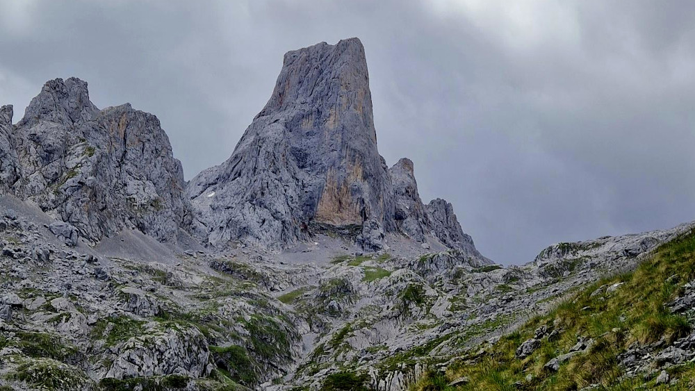
This route, opened in 1986, connects the town of Sotres with the Urriellu refuge through the Pandébano pass. It is a shorter and more comfortable alternative to the old Camburero ascent, allowing you to observe the transition from mid-mountain meadows to the high mountains of the Central Massif, with the Naranjo de Bulnes or Picu Urriellu, as the main protagonist.
Technical Data
- Type of route: Linear (out and back).
- Length: 12 km (one way) / 24 km (total).
- Level: 1,070 m ascent.
- Duration: 4 hours (ascent) / 7.5 hours (round trip).
- Difficulty: Medium (due to the length and the slope). High in winter (snow/ice).
Itinerary Description
- Start (Sotres) The route begins before reaching Sotres, at a bend in the road from where a track heads south. After 1.5 km you reach the Invernales del Texu (880 m).
- Initial ascent: You cross the huts and climb up a wide track (with possible shortcuts) to the Collado de Cuaceya and then to the Majada de Canero (1.120 m), where the track ends.
- To Pandébano and Terenosa: A trail leads to Collado de Pandébano. There you should ignore the path to the right (towards Bulnes) and take the one to the left towards Majada de la Terenosa (1,315 m), where there is a shelter and shepherds' huts.
- El Hayedo y Collado Vallejo: The path ascends bordering the hayedo de la Varera until you reach a key point: Collado Vallejo (1,540 m). From here you have an imposing view of the north face of Naranjo de Bulnes. Note: This point is dangerous with strong wind, snow or ice.
- Final stretch: The path narrows (open path with pick and shovel). After a slight descent, a constant zigzagging ascent begins, leaving Jou Lluengu to the right, until finally reaching the Vega de Urriellu and the Julián Delgado Úbeda refuge (1,950 m).
Recommendations and Safety
- Planning: Being linear and long, it requires good physical shape. You can stay overnight at the refuge or combine it with the PR-19 route to descend through Bulnes.
- Precautions: Be extremely careful in Collado Vallejo during the winter or in bad weather. There is a risk of falling stones in the upper area of the forest.
Equipment: Essential hiking boots, water and food.
Length (Km)
10.29
Max height (m)
1952.00
Min height (m)
863.00
Absolute Density (m)
1088.00
Positive Cumulative Elevation Gain (m)
1295.00
Difficulty Level