
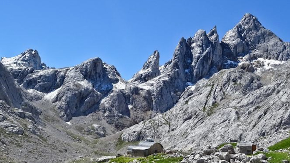
MOST IMPORTANT WARNING: this route has been de-categorized as PR (Pequeño Recorrido) due to its extreme hardness and unevenness. It is a very demanding high mountain route, although in the absence of a new name, the old one is still used.
- Type: Linear (out and back on the same path).
- Distance: 8.5 km (one way) / 17 km (total).
- Duration: 5 hours and 45 minutes (only uphill).
- Difficulty: +1,780 m of ascent (a physical barbarity).
- Difficulty: High/Very High (steep terrain, climbs and extreme unevenness).
General Description It is considered one of the hardest routes in the Picos de Europa. It leads to the José Ramón Lueje refuge (2,030 m), isolated in the heart of the Central Massif. Recommendation: Due to its difficulty (more than 11 hours round trip), it is strongly recommended to do it in two days, staying overnight at the refuge.
The Route
- Poncebos to Bulnes: You leave Poncebos (250 m) crossing the Jaya bridge and going up the Canal del Texu. You reach the Colines Bridge and turn right towards the Barrio de Arriba de Bulnes.
- Note: You can save this first hour and 430 m of vertical drop by using the funicular.
- Canal de Amuesa: From Bulnes, the trail climbs very directly and obviously up this long and steep canal until reaching the Majada de Amuesa (1,360 m).
- To the High Mountain: From the majada, the trail becomes high mountain terrain (milestones and paint marks). You climb the Cuesta del Trave, going from grass to pure rock.
- Technical Steps: The final part is complex. You have to pay close attention not to lose your way between boulders and rocks. There are sections where it is necessary to climb and areas equipped with fixed ropes to overcome the difficulty.
- Arrival: Finally you reach the pass and the Refugio de Cabrones (2,030 m), in a wild environment surrounded by the highest summits.
Length (Km)
20.04
Max height (m)
2055.00
Min height (m)
210.00
Absolute Density (m)
1846.00
Positive Cumulative Elevation Gain (m)
2460.00
Difficulty Level